The droplets that fall from the sky are not always the same. At times they are raindrops, striking eaves and streets; at other times they are snowflakes, gently covering rooftops and fields. Both arise from moisture within the clouds, yet they ultimately take on entirely different forms. This contrast not only shapes the face of the seasons but also influences ways of life and cultural habits.
What, then, are the factors that cause the same clouds to release rain on some occasions and snow on others?
The birth of clouds begins with the water cycle. When sunlight strikes oceans, lakes, or rivers, water molecules continually evaporate into the atmosphere, becoming invisible vapor. Plants, too, release moisture through respiration and transpiration, gradually filling the air with humidity.
These vapors rise with warm air into higher altitudes. As elevation increases, pressure falls and the air cools; once the temperature drops to the dew point, the vapor reaches saturation. At that moment, tiny particles in the air—such as dust, salt, or pollen—serve as condensation nuclei, upon which the vapor adheres and condenses into minute droplets or ice crystals.
Countless droplets or crystals then remain suspended in the air, clustering together to form the clouds visible to the human eye. Low-level clouds consist mainly of water droplets, appearing dense and heavy, while high-level clouds are composed largely of ice crystals, appearing light and translucent. The shape and altitude of clouds are the outcome of the combined effects of temperature, humidity, and air currents within the atmosphere.
Clouds remain suspended in the sky not because they are weightless, but because the droplets or ice crystals within them are exceedingly small. Their diameters are typically only a few micrometers, so light that their weight is almost negligible. As such particles fall through the air, they encounter strong resistance, descending at a very slow rate—often slower than the upward currents that carry them.
Warm air currents frequently rise within the atmosphere, acting like an invisible lift that pushes these tiny droplets upward or keeps them aloft. In addition, turbulence and convection continually stir the air, causing droplets or ice crystals to tumble and drift rather than settle directly downward. In other words, clouds persist in the sky because, although gravity pulls them downward, the combined effects of updrafts and air resistance counterbalance that tendency to fall.
Clouds do not immediately produce rain or snow upon forming. Whether they transform into precipitation depends on whether the droplets or ice crystals within them can continue to grow and eventually overcome the support of the atmosphere. When the particles remain tiny, air resistance and rising currents are sufficient to hold them aloft, allowing the cloud to float steadily in the sky.
If moisture continues to be supplied, however, droplets or crystals collide and merge within the cloud, gradually increasing in size and weight. Once their rate of descent exceeds the lifting force of the updrafts, the cloud loses its balance, and the particles begin to fall, initiating precipitation.
For droplets or crystals to actually reach the ground, the atmosphere must also contain sufficient humidity. If the air is too dry, the particles may evaporate during their descent, preventing precipitation from reaching the surface. In other words, only when cloud particles grow large enough to overcome atmospheric support and avoid evaporation during their fall can a cloud truly yield precipitation.
When the ice crystals or droplets formed within a cloud begin to descend, if they encounter a layer of air warmer than the freezing point, the crystals gradually melt, losing their crystalline structure and turning entirely into liquid drops. These drops continue downward and reach the ground as rain. The essential condition for rainfall is the presence of a sufficiently thick warm layer in the atmosphere, preventing the crystals from remaining solid and ensuring complete melting.
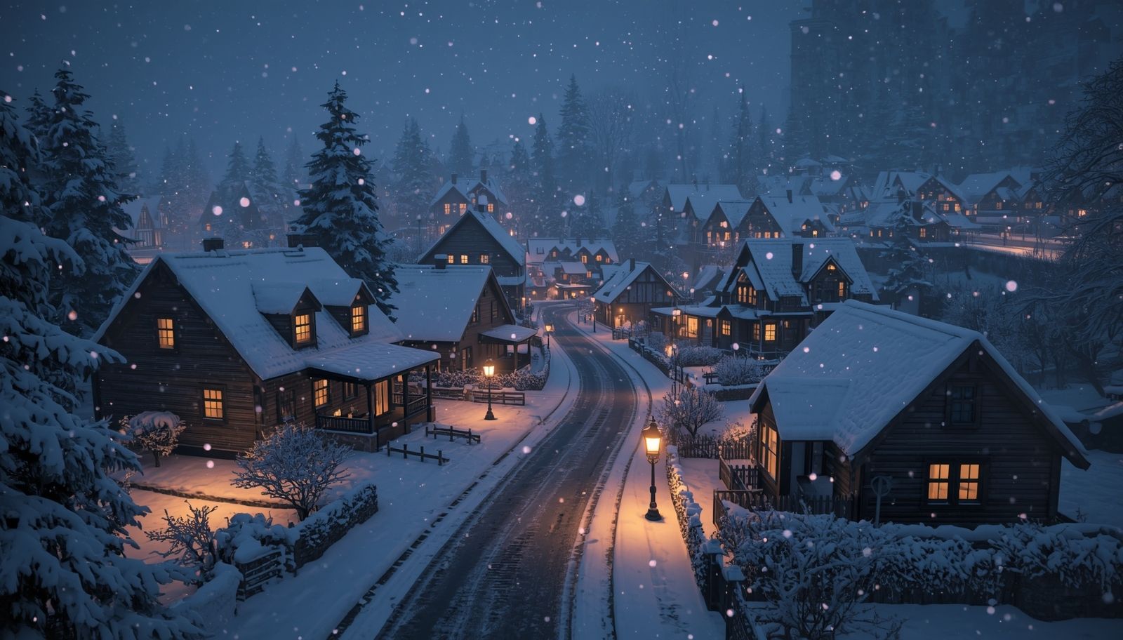
Conversely, if the entire column of air from the cloud to the ground remains below freezing, the ice crystals can preserve their solid state throughout the descent, without melting, and reach the surface as solid ice particles—this is snowfall. During their fall, they may adhere to one another, forming larger snowflakes. The key to snowfall lies in an atmosphere cold enough to allow the ice crystals to remain solid for the entirety of their journey.
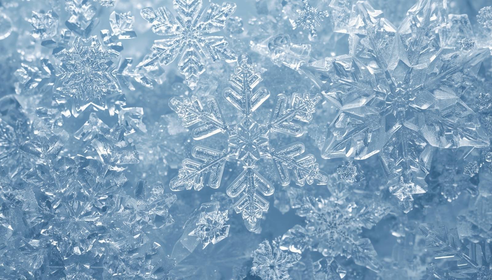 Crystals
There are also some interesting and familiar phenomena, namely ice pellets, freezing rain, and sleet.
If ice crystals encounter a layer of warm air while descending, their outer surfaces begin to melt, turning partly or entirely into liquid drops. Before reaching the ground, if the atmosphere cools again and the cold layer is sufficiently thick, these partially melted drops refreeze in midair, forming small solid pellets. By the time they strike the surface, they are already hardened particles, often accompanied by a crisp tapping sound—this is the formation of ice pellets.
If, however, the cold layer is too thin to refreeze the drops while airborne, they remain liquid until they reach the ground, where they instantly freeze upon contact with cold surfaces, creating a transparent glaze of ice—this is freezing rain.
The condition for ice pellets is a cold layer thick and effective enough to allow drops to refreeze before reaching the ground. Freezing rain, by contrast, remains liquid in the air, appearing like ordinary rainfall, but quickly turns to ice upon landing, producing dangerously slick surfaces.
Sleet is more complex. When ice crystals fall through warm air, their outer layers begin to melt, partially turning into liquid. Yet before reaching the ground, the atmosphere cools again, and these particles do not fully melt, retaining part of their solid structure. As a result, they arrive at the surface in a mixed state—half snow, half rain. The occurrence of sleet reflects an uneven vertical temperature profile in the atmosphere: not cold enough to preserve the crystals entirely as snow, yet not warm enough to melt them completely into rain.
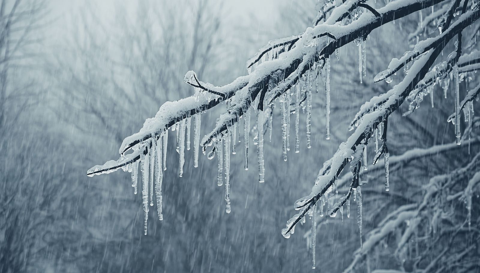 A scene of freezing rain
So what is hail, and how does it differ from ice pellets?
Hail is a form of solid precipitation, but unlike ice pellets, it is not a light crystalline particle. Instead, it is a hard lump of ice encased in multiple frozen shells. Its size can vary dramatically, ranging from small grains the size of soybeans to chunks as large as a fist. When hailstones strike the ground, they often deliver powerful impacts, capable of shattering glass, damaging crops, and even endangering human safety.
The formation of hail depends on the intense convective activity within thunderstorm clouds. When supercooled droplets or small ice crystals are present, strong updrafts carry them into higher, colder regions of the cloud, where they rapidly freeze into initial ice nuclei. These nuclei do not immediately fall; instead, they are repeatedly lifted by the updrafts, encountering new supercooled droplets each cycle. With every pass, a fresh layer of ice forms around the nucleus. Through this repeated freezing, hailstones grow larger, developing concentric layered structures.
Once a hailstone becomes too heavy for the updrafts to support, it drops out of the circulation and begins to fall. During descent, it may still collide with droplets or crystals, adding further thickness. Ultimately, it reaches the ground as a solid block of ice. The size and intensity of hail depend on the duration of convective activity and the strength of the updrafts within the cloud.
In other words, hail is produced by repeated cycles of freezing within strong thunderstorm updrafts, resulting in large, multi-layered ice masses; ice pellets, by contrast, form through alternating warm and cold layers in the atmosphere, refreezing in midair into small, simple solid grains.
| Rain | Snow | Ice Pellets | Freezing Rain | Sleet | Hail | |
|---|---|---|---|---|---|---|
| Formation | Ice crystals encounter a thick warm layer during descent → fully melt into water drops | The entire air column from cloud to ground remains below freezing → ice crystals stay solid | Ice crystals partially or fully melt → near the ground encounter a thick cold layer → refreeze in midair | Ice crystals fully melt into water drops → near the ground encounter a thin cold layer → cannot refreeze in air, freeze instantly upon contact with the surface | Ice crystals partially melt → near the ground encounter a cold layer → do not fully melt | Strong updrafts in thunderstorm clouds → ice nuclei repeatedly lifted into cold layers → multiple cycles of freezing and thickening → fall once weight exceeds updraft support |
| Characteristics | Liquid drops reaching the ground, the most common form of precipitation | Light crystalline structures, often clumping into snowflakes | Small solid pellets, striking the ground with a crisp sound | Liquid drops fall, then freeze instantly on cold surfaces into a clear ice layer | A mixed form of half snow, half rain | Hard ice lumps with multiple shells, size varies greatly |
| Impact | Generally mild, nourishing the ground | Accumulates into snow layers, disrupting transport | Harder to melt and clear than snow | Hazardous, creating slick ice surfaces and high risk of accidents | Similar to snowfall in effect | |
| Highly destructive, capable of damaging buildings, crops, and vehicles |
In reality, places where snowfall is more likely usually share several common features. First are regions at higher latitudes—for example, the mid-to-high latitude zones of the Northern Hemisphere—where cold air dominates for long periods in winter, keeping temperatures below freezing and allowing ice crystals to reach the ground as snow.
Second are mountainous areas at higher elevations, since temperatures drop with altitude, making the summits more prone to snowfall; this is why ranges such as the Alps, the Himalayas, and the Rockies remain snow-covered year-round. Third are coastal regions influenced by cold ocean currents or polar air masses, which also favor snowfall—for instance, the eastern seaboard of North America, often affected in winter by Arctic air moving southward, bringing widespread snow.
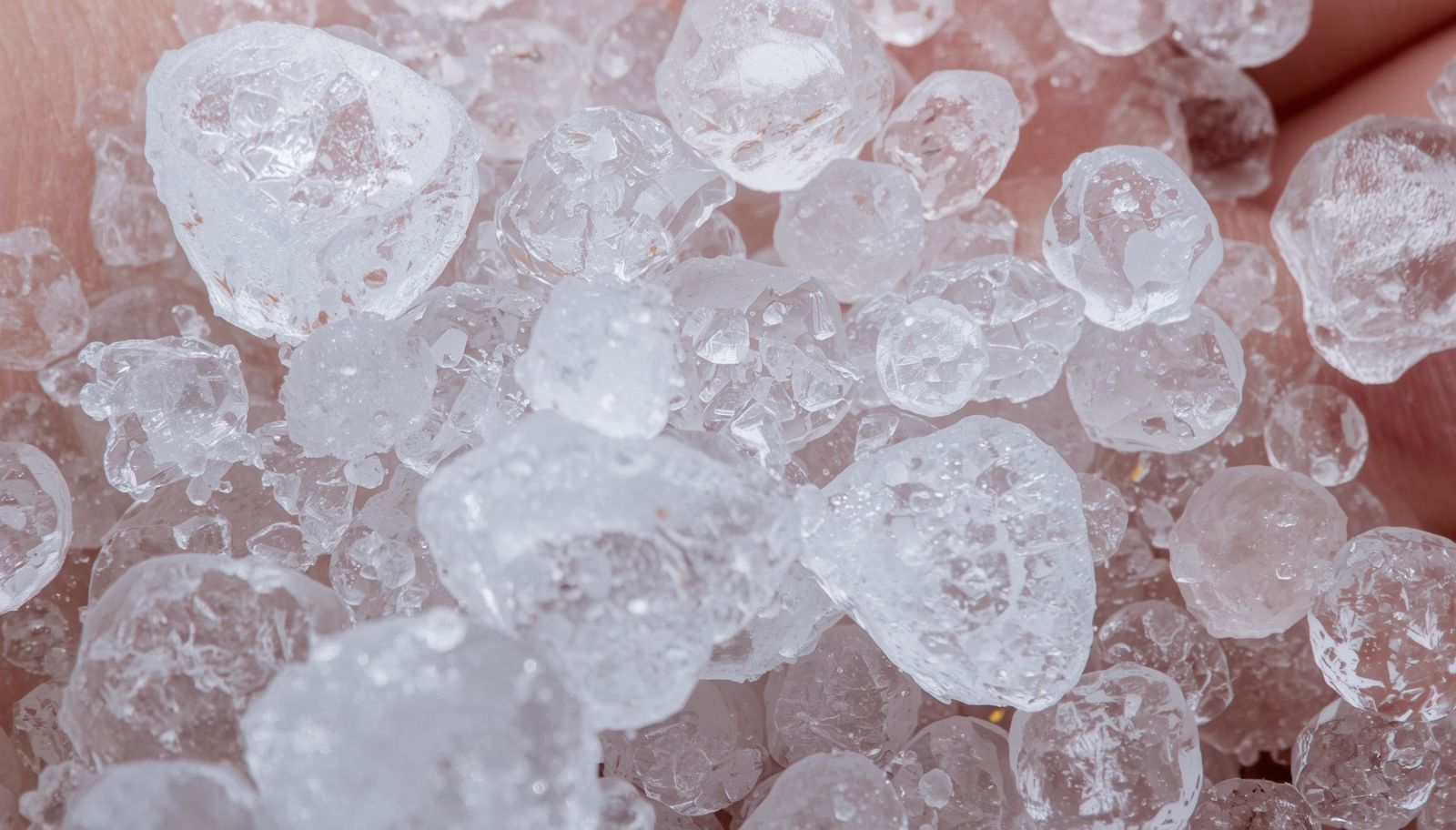 Hailstones
We leverage big data to bring you the most fascinating and mind-blowing trivia. Follow us for regular updates—prepare to be amazed while leveling up your knowledge.
Tattooing has been recorded since ancient times, often serving religious purposes, marking identity, or functioning as punishment. In more recent history, tattoos were also regarded as symbols of

Bees are among the most familiar insects to humans. They flutter among flowers, collecting nectar, and often appear to embody diligence and charm. Yet behind this gentle exterior lies a harsh law of

In discussions about food, we often hear the terms sugar, saccharides, starch, and carbohydrates. Are they the same thing? Saccharides and carbohydrates refer to the same category of substances.

The current global situation of myopia has become a significant public health issue. With the advance of urbanization and the widespread use of technology, human lifestyles have undergone profound

We often forget different things, but many of them are ones we’d rather remember—especially when studying or learning, where newly acquired knowledge seems to slip away quickly. How does the human

Does vaccination mean injecting the virus into yourself? After all, it doesn’t necessarily cause illness. Even if someone becomes infected and later recovers, wouldn’t they also develop antibodies?

Magnetic Levitation (Maglev) trains are famous for their high speed, but how can such heavy trains float? And why do they need to float at all? ### Operating Principle A maglev train is a

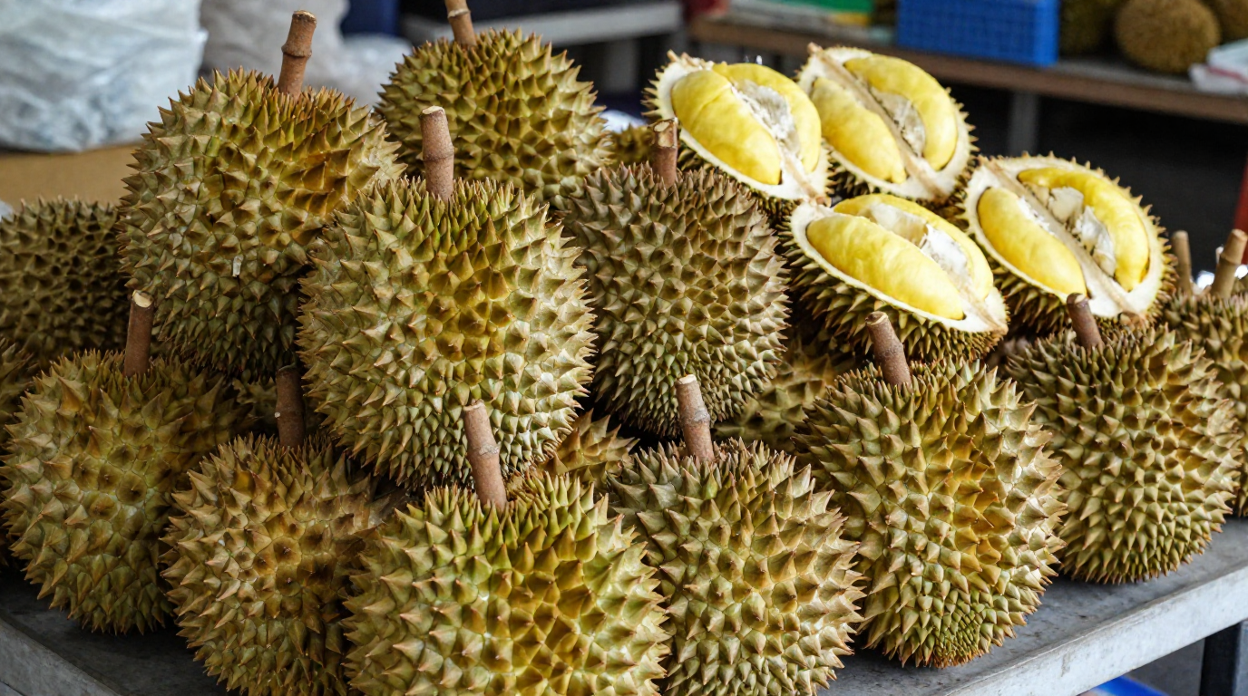
Durian, hailed as the “King of Fruits,” is renowned for its thick, spiky shell and its powerful aroma. Its appearance serves both as a natural defense and a sign of ripeness, while its distinctive


Follow us for quirky updates, fun discoveries, and a front‑row seat to the weird and wonderful world we live in.